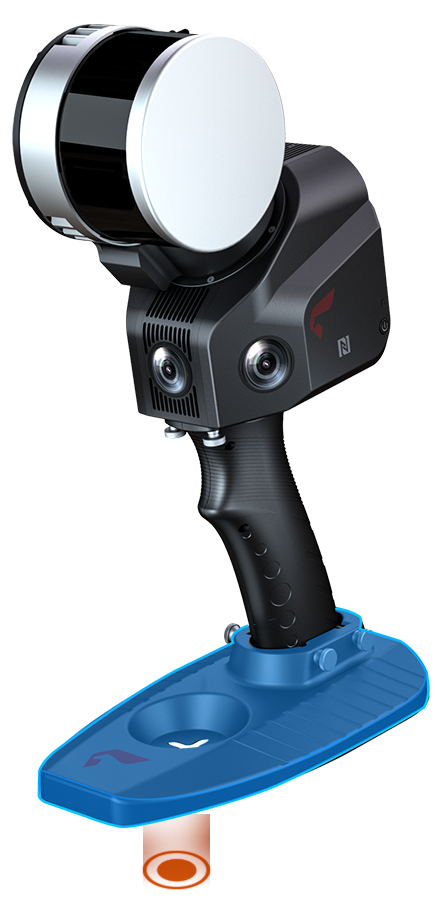
SLAM100
Handheld Laser Scanner
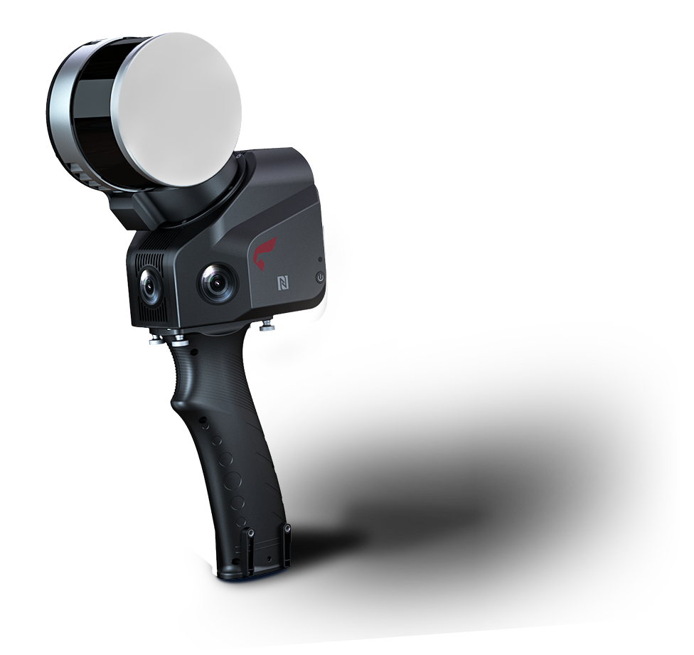
SLAM100
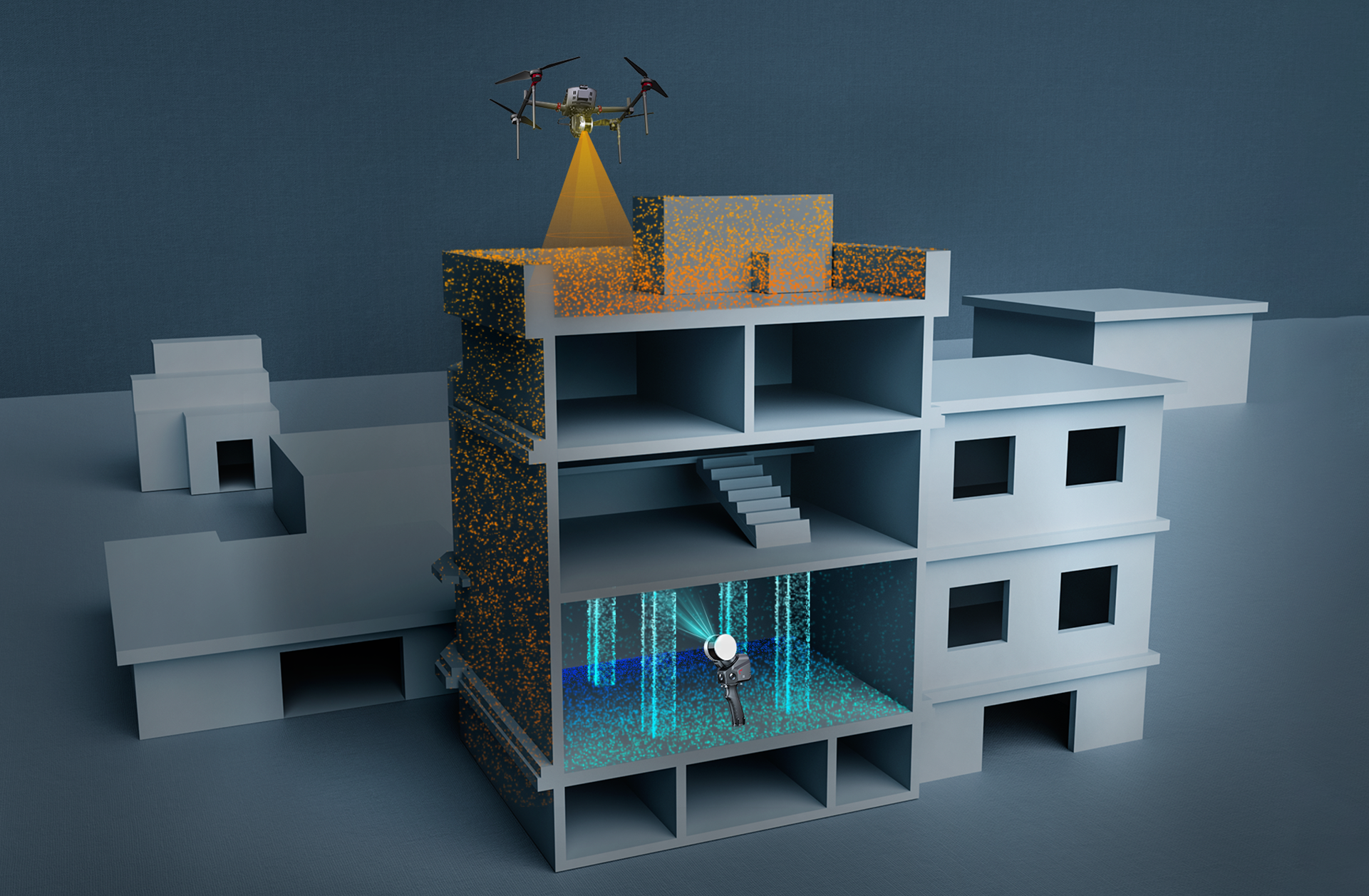
SLAM100 is the first handheld mobile lidar scanner launched by Feima Robotics. The system has a 360° rotating head, which can form a 270°×360° point cloud coverage. Combined with the industry-level SLAM algorithm, it can obtain high-precision three-dimensional point cloud data of the surrounding environment without light and GPS.
| Laser Scanning FOV | Absolute Accuracy |
| 270°×360° | 5cm |
| Laser Pulse Repetition Rate | Maximum Range |
| 320kHz | 120m |
| Camera Resolution | |
| 5Megapixels |

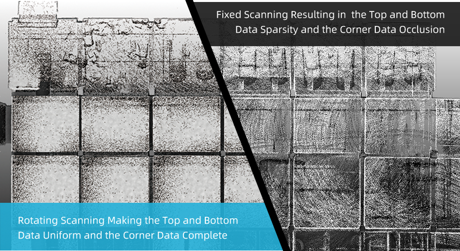
Through rotating scanning, the Laser Scanner of SLAM100 can dynamically collect data and form a 270°×360° field of view, making it accurate and complete to acquire data from the space around us.
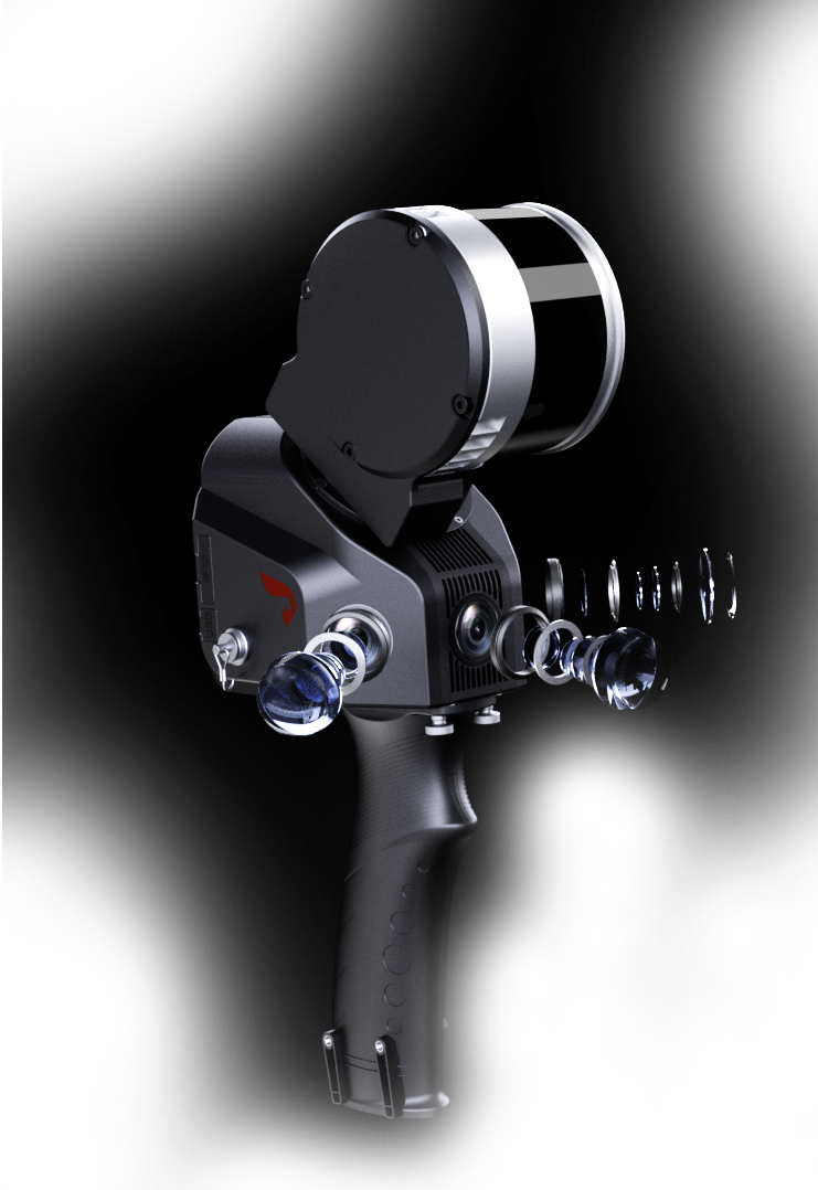
The Visible Light Cameras
Three 5-megapixel cameras are adopted to form a horizontal 200-degree field of view and a vertical 100-degree field of view, which can synchronously obtain texture information and to furthermore produce color point clouds and partial panoramic images.

Schematic Diagram of Data Cloud and Image Fusion
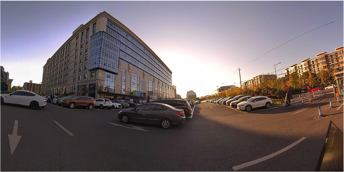
Partial Panorama Image
High Precision and High Definition
Industry-level SLAM post-processing algorithms enable SLAM100 to obtain higher precision and finer 3D point cloud data.
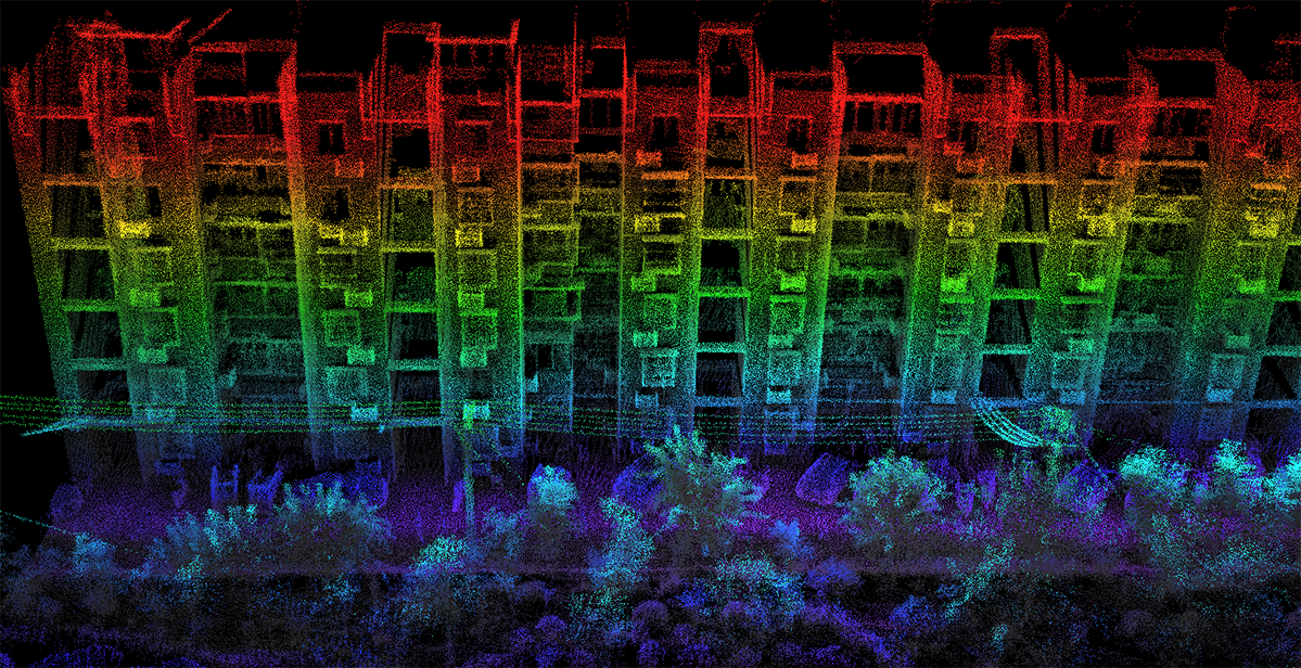
A Certain Residential Area
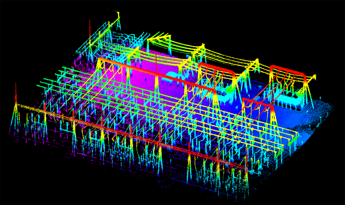
Transformer Substation
Automatic Control Point Measurement
Without the need to manually add control points, SLAM100 can actively collect and automatically extract the control points and thus easily georeference the result data in the global coordinate system.
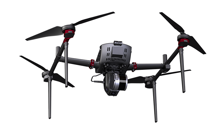
UAV Mount
SLAM100 can be equipped to the Feima's UAV platforms of D500 or D20 via a UAV mount, so as to carry on air-ground or indoor and outdoor data collection.
Versatile External Interfaces
SLAM100 has a wealth of external interfaces, which can be connected to a panoramic camera, a GPS module, a car, a UAV and so on, to diversify data collections and adapt to more application scenarios.

Omnidirectional Camera
|

GPS Module
|

UAV
|

Car
|

Package
|

External Power Supply
|
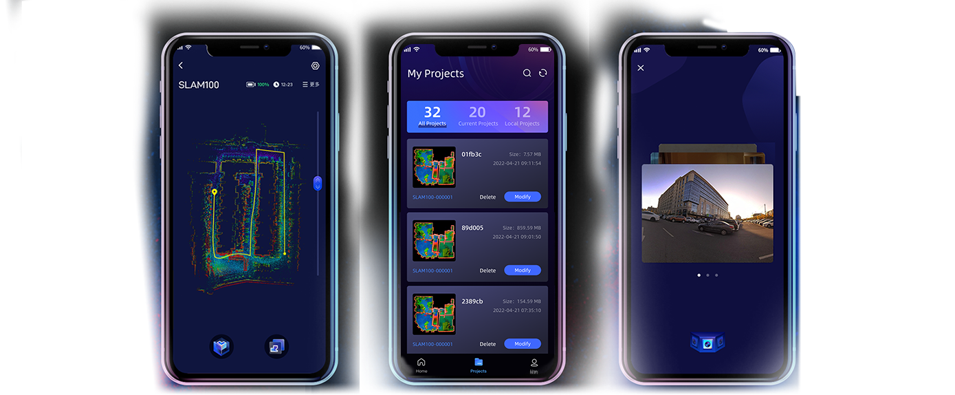
SLAM GO APP
SLAM GO is a mobile application developed in conjunction with SLAM100. The APP can be connected to SLAM100 through a cell phone, and can perform project management, real-time point cloud display, image preview, firmware upgrade and other operations. The APP is synchronously adapted to Android and iOS operating systems.
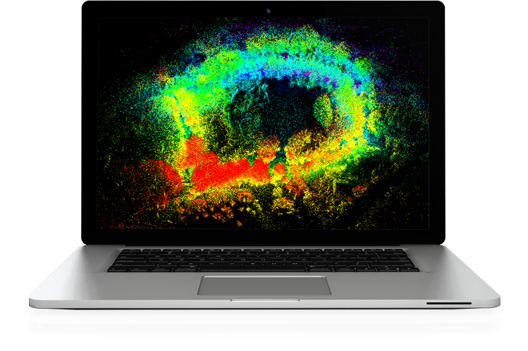
SLAM GO POST
SLAM GO POST, embedded in the UAV Manager Professional Edition, is a Pc software that is compatible with SALM100. The software can perform post-processing of collected data, generate high-precision and high-definition color point clouds, produce partial panoramic images, display point clouds and perform optimization processing.
Application Scenarios


Reverse Engineering
|
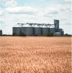
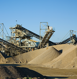
Capacity Measurement
|

Acceptance Survey
|

Karst Cave and Roadway
|

Forest Inventory
|

Facade Survey
|

Topographic Mapping
|

Real Estate Surveying and Mapping
|

Digital Management
|
Spatial Analysis
|

Cultural Relics Protection
|
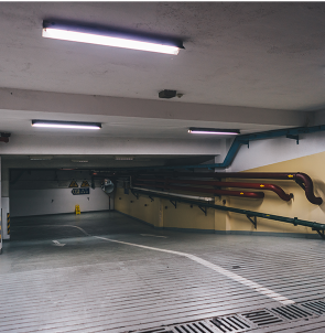
Underground
|
|
Reverse Engineering
|
Capacity Measurement
|
Acceptance Survey
|
|
Karst Cave and Roadway
|
Forest Inventory
|
Facade Survey
|
|
Topographic Mapping
|
Real Estate Surveying and Mapping
|
Digital Management
|
|
Spatial Analysis
|
Cultural Relics Protection
|
Underground
|
